


RF Path provides propagation loss calculations for radio frequencies (RF) between 20 MHz and 20 GHz using either the Irregular Terrain model, Okumura-Hata model, COST-231 Hata Extension model, or the COST-231 Walfish-Ikegami model. The calculations are based on both electromagnetic theory and the statistical analysis of terrain characteristics to calculate the degradation of the RF wave as a function of distance and the variability of the RF wave with respect to time and space.
The Irregular Terrain Model has two different prediction models. One is the Area Prediction mode which calculates propagation losses over an area where the exact terrain parameters are not known, but approximated using terrain roughness, environmental parameters and statistical parameters.
The second is a point-to-point mode where specific latitude/longitude pair values are entered for both transmitter and receiver. Environmental parameters and statistical parameters are also used in this prediction mode.
The results may be saved to iCloud, emailed, or posted to Facebook or Twitter. The results are in CSV format.
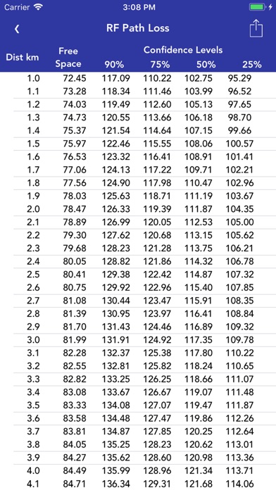
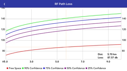
In the Area Prediction mode a table along with a graph shows the path loss over the distance entered into the settings. The graph is viewed by rotating the device once the results table is shown.
In the Point-To-Point Prediction mode a table along with a graph shows the path loss and elevation profile of the RF path.